High Quality Maps of the Polis area in Cyprus
Polis - Nothing Else in Cyprus Compares
The area surrounding Polis is arguably the most serene and idyllic area in all of Cyprus. Relatively unspoiled, the beautiful scenery bombards your senses with spectacular contrasts of nature where the blue Mediterranean Sea meets the green steep mountains of the Akamas National Park.
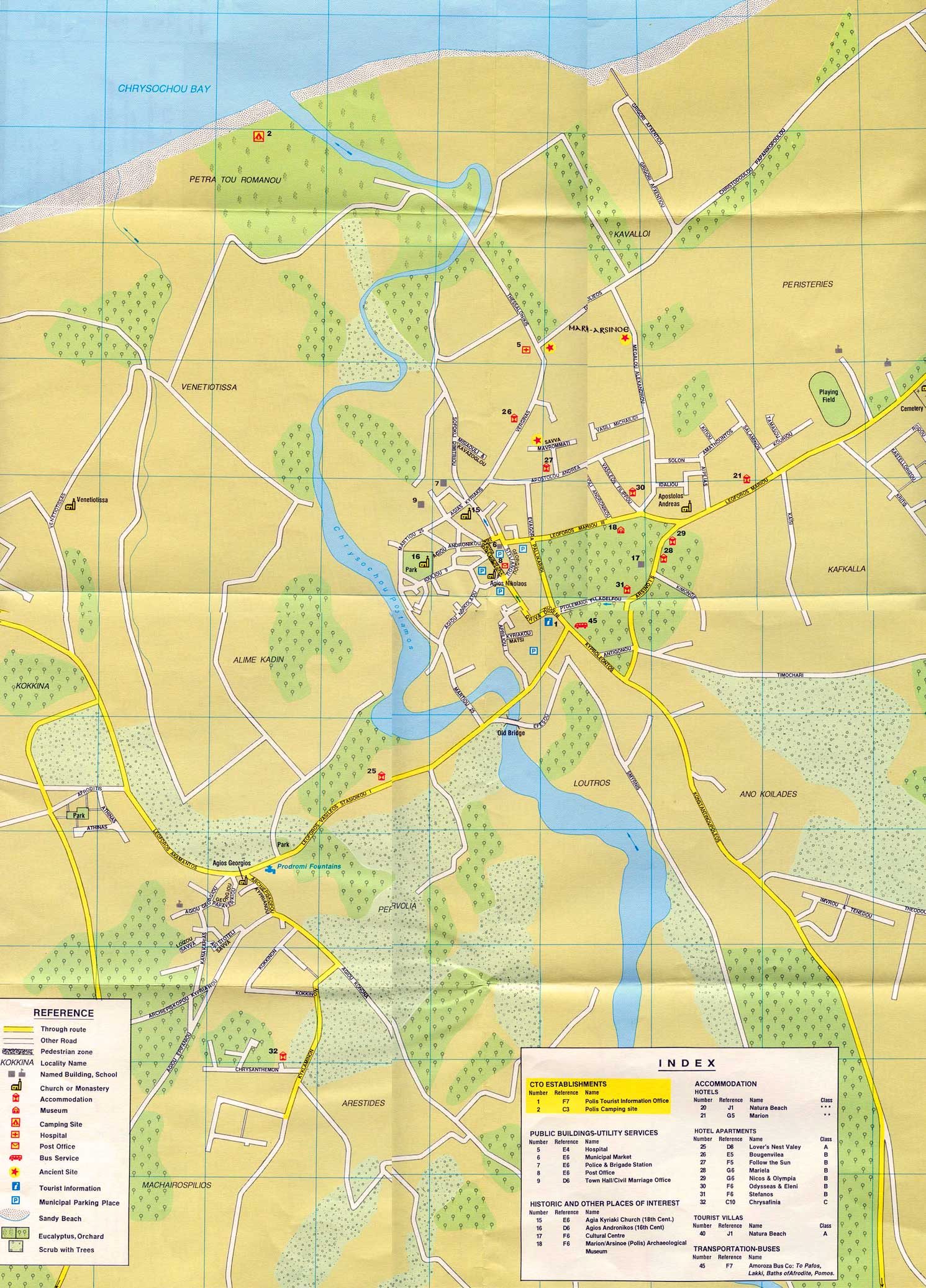
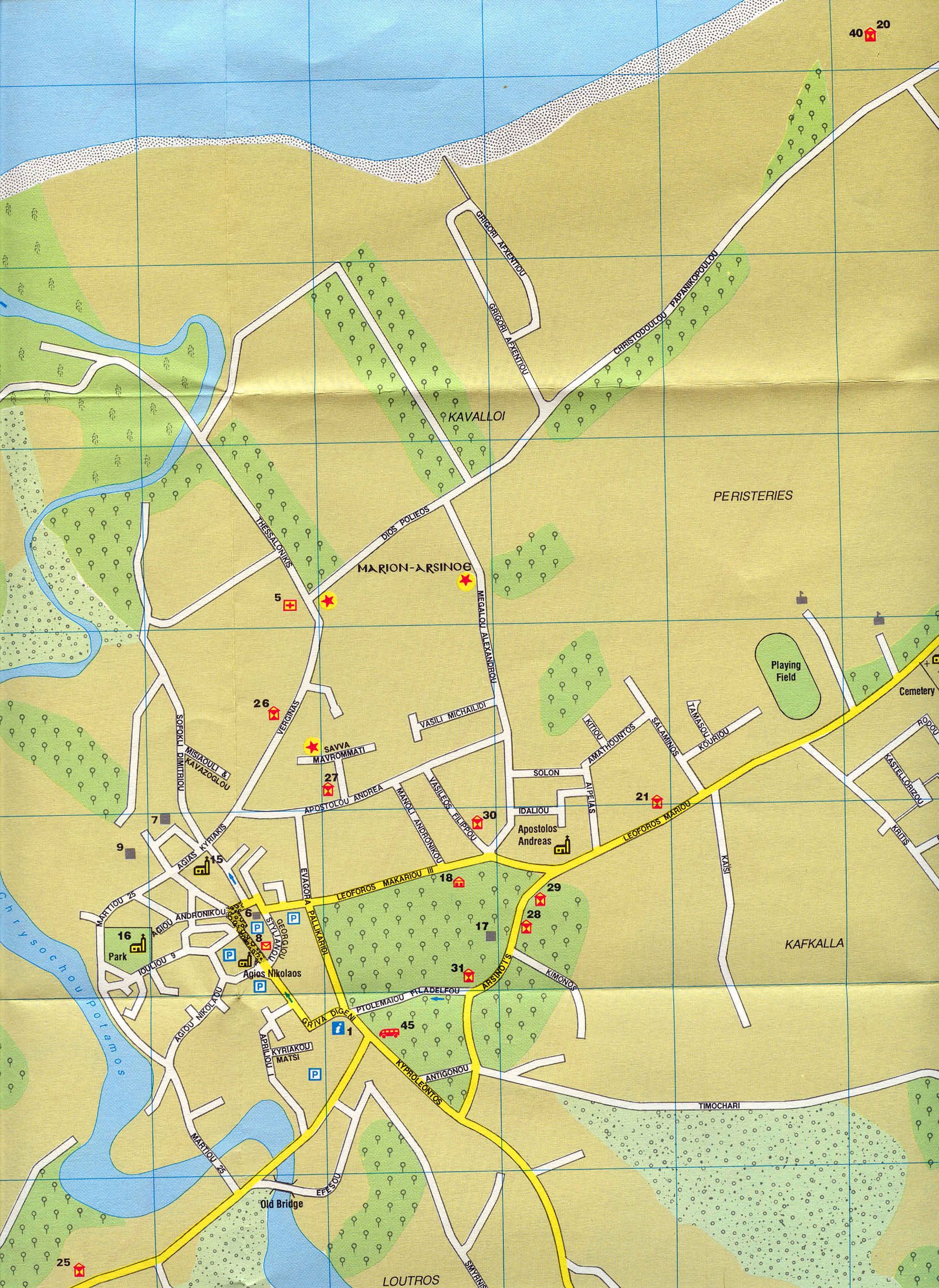
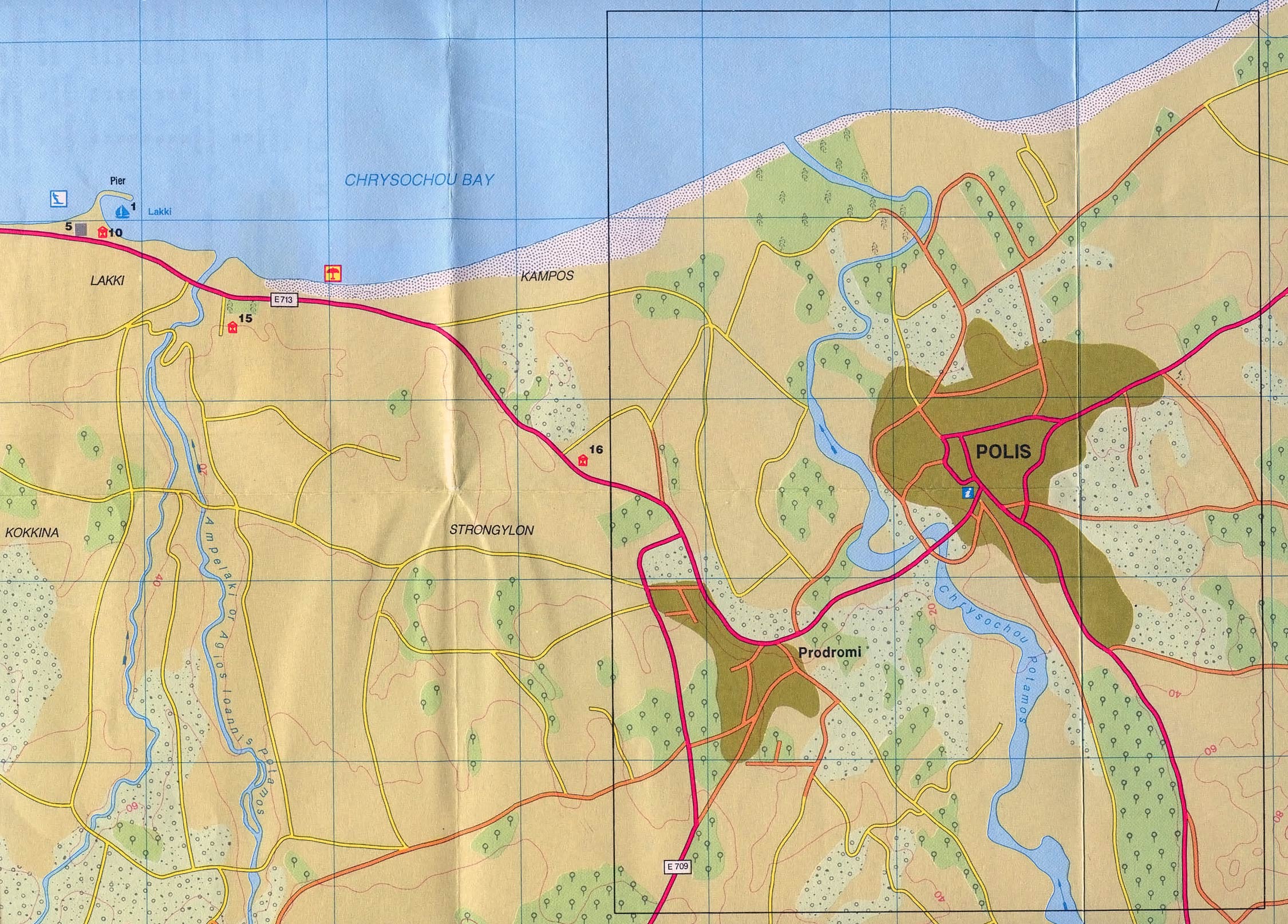
In the north west of Cyprus, 25km from Paphos, Polis seaside town is on the edge of the Akamas National Park and sits in the centre of Chrysochous Bay; it is one of the least developed beach resorts in Cyprus. Dotted with citrus groves overlooking the clear turquoise sea, the Polis area expands beyond the town itself encompassing a truly magical and diverse landscape ranging from rocky promontories to lush meadows.
Latsi (also known as Latchi and known locally as Lakki) is the picturesque harbour of Polis. With its coastal paved promenade and long sandy beach, Latsi is most famous for its exceptional fish tavernas, water sport facilities and boat trips up to Akamas. Latsi offers a relaxed tranquil way of life in exceptional surroundings; while it has certainly grown over the years, Latsi has retained its natural environment at the heart of that growth.
Further along the coast to the west are the Baths of Aphrodite where the road ends and the Akamas National Park starts.
Inland there are some charming villages to enjoy. Droushia and Inia are notable. Heading north the road runs through the village of Argaka along the coast to Pomas and on to the end of the road at Kato Pyrgos.